
1 week on the Grande Traversata delle Alpi
We hiked for one week (8 days) at the beginning of August 2023 on the little know GTA, or Grande Traversata delle Alpi, starting just outside of Domodossola. From San Lorenzo to Piedicavallo, we walked 134 km and went up 10722 high meters! It is a demanding hike; the altitude differences each day are brutal. Every day we crossed a pass, went down to the bottom of the valley and hike back up again. It is all worth it though, this region is a hidden gem! Here you will find our experiences and our intinerary.
- Preparation and travel
- Accomodation
- Food and water
- Day 1 – 8.5 km, 1226 m up, 118 m down
- Day 2 – 15 km, 614 m up 1836 m down
- Day 3 – 22.7 km, 2223 m up, 1365 m down
- Day 4 – 17,3 km, 1376 m up, 1588 m down
- Day 5 – 22 km, 1686 m up, 1759 m down
- Day 6 – 13,8 km, 1729 m up, 929 m down
- Day 7 – 25 km, 1540 m up, 1344 m down
- Day 8 – 10,5 km, 313 m up, 1582 m down
Preparation and travel
Well, we are notoriously bad planners, but we did some googling on the GTA. That’s how we found the GPS tracks here, which we loaded into our trusty maps.me app. Living in Switzerland we are spoiled with well-sign posted trails (really, it’s hard to get lost hiking in Switzerland), and we heard that this is not the case for the GTA. We even bought a guide book (by Werner Bäntzig, German only); which comes in 2 parts, North and South. We did not take it with us though, as it is pretty heavy. We just took pictures of the pages we wanted to have handy.
There are several places where you can start the hike. The official start is at Molini di Calasca in Valle Anzasca; however, Forno in Valstrona is also used, and some walkers start at the Nufenenpass in Switzerland.
We took the train to Domodossola, where we enjoyed some Italian espresso and food, as well as stocking up on food and from there the bus to Bognanco, final stop San Lorenzo. The bus runs 4 times daily, the time table can be found here. We arrived at 3 in the afternoon and immediately started the hike; we still had some hours of daylight left.
We ended our stretch of the GTA at Piedicavallo; from here you can catch a bus to Biella (line 340, takes an hour). From Biella there are trains to Milan, Turin and Domodossola.
Accomodation
There are plenty of options for accomodation along the way; the famous posta tappi, as well as mountain huts (rifugio), private B&Bs, hotels and camping sites. However, as we like sleeping in a tent, we spend most of our nights wildcamping. Although wildcamping is normally forbidden in Italy, in this region it is tolerated. Just remember the old adagio “leave no trace” and definitly do not build any camp fires.
We stayed one night in a rifugio; Alpenrose in Carcoforo. We got lucky, we did not make reservations before and in August the accomodations are normally booked out. If you travel in August and would like to use the accomodations along the way, we strongly suggest to reserve beforehand. The whole country is on holiday and some towns are tourist hot spots (like Alagna). Some fellow GTA-hikers had troubles finding a place to stay, especially in the weekends or around the 15th of August, a national holiday in Italy.
Food and water
If you are camping, like we were, you have to plan ahead food-wise. Fortunately, every day we passed through villages or by mountain huts where we had warm food for lunch (and wine!). However, grocery shopping is a bit of a hassle. We stocked up in Domodossola, so we had plenty of snacks and we always carry some back-up pot noodles (which we did not need). We passed through Antronapiana on day 2, where there was a small store. The next one was in Carcoforo (day 5), where you can get some supplies (albeit very limited) in Rifugio Alpenrose or at the farm opposite. The next biggest town is Alagna, for us at day 7, where there is a small family-owned store and an amazing bakery.
Water was not a problem at all. There are plenty of springs and taps on the way. We carried around 4 liters of water with us (August is hot!) and we never got without. All the water is safe to drink, only once or twice we passed a tap that said “uncontrolled water” or “unpotable water”. Most springs and taps are clearly marked in OpenStreetMaps. We always bring a water filter with us for emergencies; as there is a lot of cattle and sheep around, we wouldn’t drink water from creeks and rivers without treating it first.
Day 1 – 8.5 km, 1226 m up, 118 m down
We started our hike at 3 o’clock from San Lorenzo; with sunset around 9 we wanted to make use of the daylight and get warmed up. From the bus stop, we followed the road to Pizzanco and hiked up following the creek. After 5 km steady up we merged with the GTA route. We passed the Rifugio Alpe il Laghetto, over the pass and started to look for a flat bit of land to pitch our tent. It took a while, and it was very windy, but after a total of 8.5 km we found an acceptable spot to spend the night.


Day 2 – 15 km, 614 m up 1836 m down
After an early rise, we made our way up to the Passo della Preja, which was a bit of a scramble. We were completely alone on the trail, apart from some marmots. After the pass we slowly made our way down to the lake Alpe del Cavalli with it’s amazing blue colour. Here it got busy again, with lots of day hikers enjoying the hike around the lake. We slipped and slid down the flank of the mountain towards the lake, the mowed grass made the descent tricky. If it’s wet on the trail, we would recommend an alternative route. At Alpe di Treste, turn west on the route C27 and go down to the lake; follow the shore to Alpe Cheggio. In Alpe Cheggio we enjoyed lunch, before continuing down. The path follows the main road, with some short cuts, down to the town of Antronapiana, where there is a small shop. From the town we walked through the forrest. We opted for stealthcamping next to the river and the main road, just before San Pietro, as we weren’t sure if we would find a flat spot later on. We were well hidden and the road was quiet during the night, so we slept well enough.

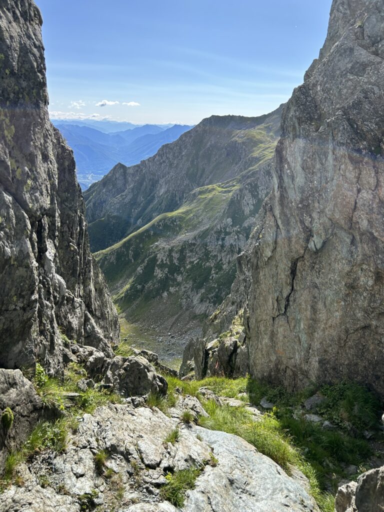

Day 3 – 22.7 km, 2223 m up, 1365 m down
From our spot at the river we followed the main road through San Pietro and Terzo Fuori, where we filled up on water. Then we turned right, off the road and into the forrest, and steep up. Luckily there were stairs, but it got us sweaty fast enough. We were suprised to find some flat bits along the path where we could have camped, which would have been a better option than our night in the bushes. At Rifugio Alpe Colma we stopped for a coffee, this was the highest point of the morning. Here we filled our water bottles again, and made our way down the other side of the ridge into the Anzasca Valley. The way down was easy on the knees, and with lots of shadow, very welcome on a hot day. From Olino a friendly dog followed us; later we found out he belonged to Alpe Colma; he stayed with us all the way down to the restaurant were we had lunch (Locanda del Tiglio). Here we also bought some fresh bread.
After lunch it was time for the second ascent of the day, and we were stupid enough to do this at the hottest time of the day. It was beautiful though, along the river through the steep valley. It starts off as a dirt road, but quickly it turns into an overgrown hiking path. At one point we got so overheated that we took a dip in the river, before making our way up through the forest. It was steep all the way to Alpe Camino; we were happy when we finally looked down on Alpe del Lago, where we pitched our tent in a field of blueberries, just behind the Rifugio. There is also a unstaffed bivouac, in case you would like to sleep inside.


Day 4 – 17,3 km, 1376 m up, 1588 m down
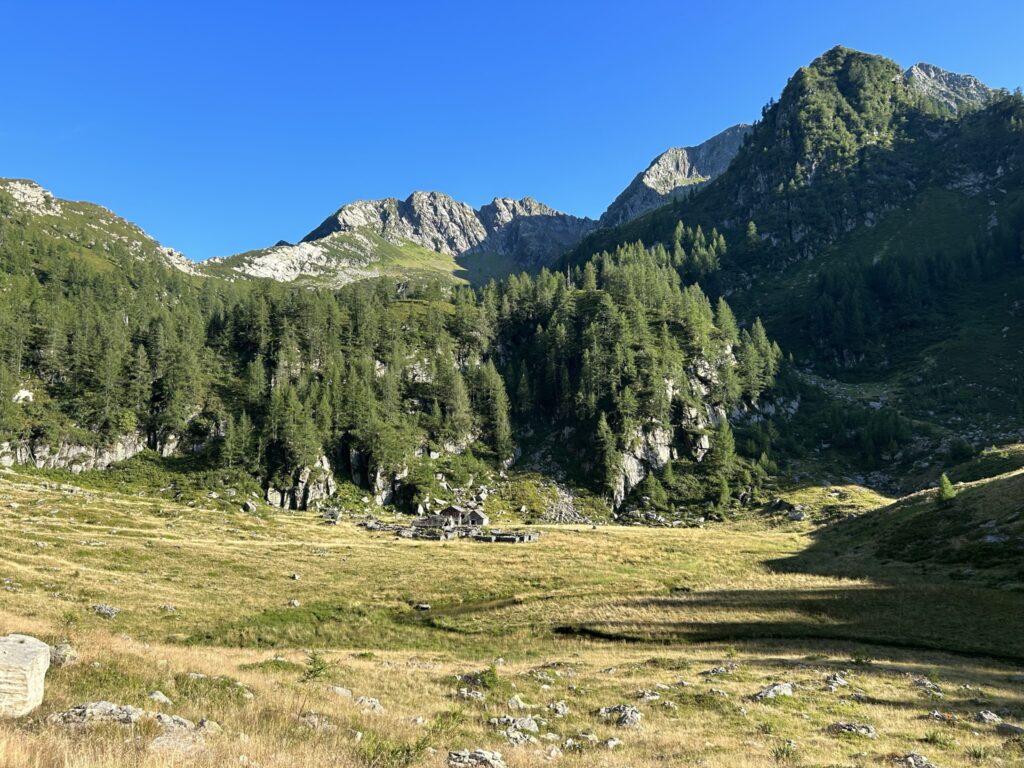
In the morning we left early, and made our way up and around to the bivouac at Alpe Pian del Lago. Not a minute too soon, a shepherd and his flock came our way and with them some pretty aggresive sheep dog. The come close and bark incessantly. At various places along the GTA we later saw signs on what to do; avoid herds (bit difficult as they are on the hiking path…), don’t shout, don’t throw rocks and slowly back down. Luckily the shephard called him back, and we could enjoy our coffee break at the hut. The next break we had at Lago di Ravinella, which was too muddy to swim in, unfortunately. Over the saddle and a tricky bit down, brought us along different alps, where the donkeys were roaming freely. Lunch we had in Campello Monti. Up to the pass of Bochetta di Campello, and going down late afternoon in the direction of Rimella. The way down is easy and gradual, along a steep flank. We had some troubles finding a flat spot for our tent, which we eventually found just before the village started. Not a great spot to camp, but it worked.


Day 5 – 22 km, 1686 m up, 1759 m down
In the morning we went quickly through Rimella, down to the river and back up the other side of the valley. At Alpe Res, we went down to the next river valley (Mastallone) and at Belvedere we lost the path; we ended up on the main road. That was fine with us, so we followed the road to La Piana, where the owner of Osteria della Piana just opened up. He rustled up some pancakes with cheese for us, a local speciality, called miacce. Perfect hiking food, if you ask us! Again we made the same mistake and started our ascent to Lago Baranca at the hottest time of the day. Luckily the ascent is very gradual and the higher up we got, the more bearable the temperatures. Again, this lake and the waterfall is a popular day hike, so it was crowded on the trail. From Lago Baranca we still had to cross to the pass Colle d’Egua. We already decided it was about time for a shower, so we didn’t mind the long day and hiked down to Carcoforo. Here we stayed in Rifugio Alpenrose. For GTA-hikers they offer bunk beds and half board. The food was delicious and we were happy with the hot shower and a chance to do laundry.


Day 6 – 13,8 km, 1729 m up, 929 m down
From Carcoforo to Rima is listed as one stage, but it is a short one. We started late, around 9 in the moring and walked up to the pass Colle del Termo in the morning heat; there is no shadow on the way up and the sun was blasting us. We had a long break at Alpe Trasinera, where there was a spring and we could dry our still damp laundry. From there it was only 400 high meters up to Colle di Termo. The way down to Rima looks impressive on the map, but the many many serpentines make the descent a piece of cake. We arrived in Rima around 3 in the afternoon and had a late lunch/early dinner. We wanted to sleep higher up, so around 5 we started our way up again when the temperatures became a bit more humane. We found a flat spot at one of the deserted houses at Alpe Vorco, where we had the most beautiful starry night.


Day 7 – 25 km, 1540 m up, 1344 m down
A bit later than planned, we started our day with going up to Colle Mud. The way up is doable, but the way down from the pass is tricky and slippery. Somehow we made it down to the busy town of Alagna, where we finally could get some fresh bread and snacks for our last day. As it became hotter and hotter, we knew we wanted to sleep as high up as possible. We also planned to take the bus the next day, so we wanted to cover some distance. However, on our way up via Riva Valdobia, where you follow the asphalt road for a while, we had to take a break for an hour to escape the heat. Late afternoon we continued in the Vogna valley, and we were glad we did it at this time of the day. The many day hikers were on their way back as we hiked up, and the higher we got, the more stunning the valley became. We can say that this valley way our favourite part of the entire trip. We were completely alone, and in the early evening, after a long hot day, we pitched our tent at the lake just below Lago Nero.


Day 8 – 10,5 km, 313 m up, 1582 m down
Our last day on the GTA. We got up early, as we had no idea about bus times at our final destination of Piedicavallo (bad planners, remember?). We still had to go over 2 passes (Passo del Maccagno and Colle Lazoney), at 2495 m and 2395 m respectively. There was quite some scrambling involved, and you stay at the same altitude for some kilometers, climbing over rocks, until we reached the final pass (Colle della Mologna grande), before scrambling down to Rifugio Rivetti. Here we had a quick coffee break, with homemade apple pie, before going down to the small town of Piedicavallo. The ascent becomes easier the further down you go. Around midday we arrived, and since the bus was scheduled to depart at half past 1, we had plenty of time for lunch. Very tired, sweaty and dirty, we spent a bit more than 1 week on the GTA. Although demanding, and we really pushed ourselves with long days, we highly recommend this trek!


